Cloud Droplet Microphysics May Be Undermining the Accuracy of Today’s Climate Models

Understanding how tiny cloud droplets behave might sound like a small detail, but researchers are discovering that these details matter far more than we once believed. A new study highlights how cloud droplet microphysics—specifically how droplets of different sizes cluster and vary across a cloud—can influence large-scale cloud behavior. And according to the researchers, many current climate models may be getting these details wrong, leading to errors that ripple outward into predictions about rainfall, cloud brightness, and even long-term climate change.
This new work, led by Nithin Allwayin and colleagues and published in Geophysical Research Letters, uses fresh observational data and advanced simulations to compare what’s happening in real stratocumulus clouds versus what models think is happening. Their conclusion is clear: the models are still too uniform, too idealized, and too simplified when representing cloud droplets. And those simplifications could be affecting how we understand clouds at the global scale.
What the Researchers Studied
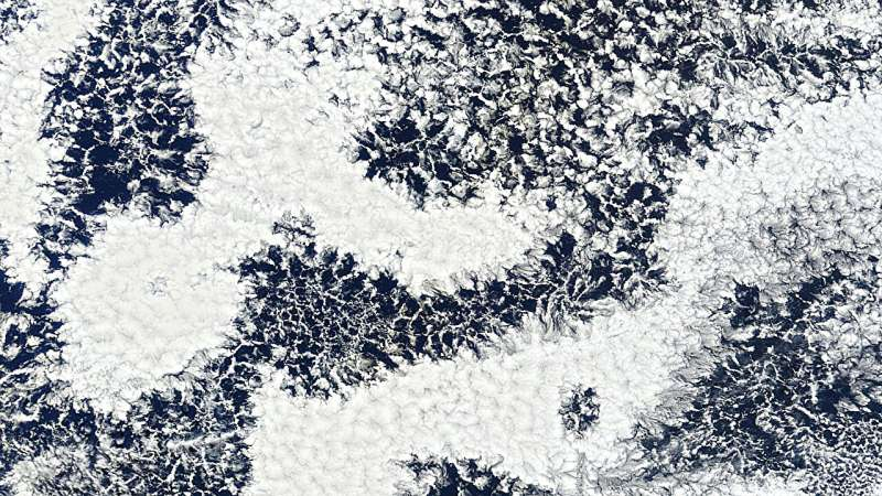
The focus of this study was stratocumulus clouds, a common type of low-level cloud that plays a major role in reflecting sunlight back into space. To understand how droplets form, grow, and cluster inside these clouds, scientists rely heavily on large-eddy simulations (LES)—high-resolution models that try to capture turbulent motions and microphysical processes.
But until recently, models lacked detailed real-world measurements to compare against. That changed when researchers began collecting centimeter-scale observations of droplet size distributions inside cloud layers. These observations revealed that droplets don’t randomly mix; they form distinct clusters with different size characteristics depending on processes like updrafts, drizzle formation, and entrainment of dry air.
Using these new measurements, Allwayin’s team compared what was actually happening in stratocumulus clouds with what LES models predicted under the same conditions.
What They Found Inside Real Clouds
In the real world, cloud droplets behave in surprisingly structured ways:
- Regions dominated by drizzle tend to have larger droplets, even though the total water content is not always higher.
- Updraft regions—areas where air is rising—have smaller droplets and a narrower range of droplet sizes.
- Droplet size distributions vary significantly across different parts of the same cloud, showing high spatial variability across large-eddy scales.
These details matter because droplet size strongly affects how clouds scatter light and how quickly they produce precipitation. Even small differences in droplet clustering can change a cloud’s brightness and lifetime.
What Models Are Getting Wrong
When the same conditions were simulated using LES models, the results diverged sharply from reality:
- On small, convective scales, the models did show some correlation between droplet clusters and cloud regions (drizzle areas vs. updrafts).
- But at larger scales, the simulations produced droplet size distributions that were too similar across the cloud.
- In other words, LES models smoothed out the natural variability seen in observations.
This uniformity is not just a small oversight—it may lead to significant misrepresentations of cloud behavior in weather forecasts and climate projections.
Why Are Models Missing This Variability?
The researchers highlight several reasons:
1. Entrainment Is Not Well Resolved
Entrainment—when dry air from outside the cloud mixes into the moist cloud interior—affects droplet evaporation and microphysical evolution. Observations show a strong relationship between droplet characteristics and local entrainment rates. But current LES models often fail to simulate entrainment with enough detail.
2. Models Assume Uniform Boundary Layer Conditions
Climate and weather models frequently assume that:
- Aerosol types
- Surface fluxes
- Boundary layer properties
are uniform across the cloud field. In reality, these properties vary significantly over horizontal distances, influencing droplet formation and growth.
3. Simulations Used in This Study Were Idealized
The authors emphasize that their LES simulations were intentionally simplified. This is useful for isolating microphysical processes but means the results may underestimate the true complexity found in nature.
Why These Findings Matter for Climate Science
Clouds are one of the largest sources of uncertainty in climate prediction. Their ability to reflect sunlight and produce precipitation depends heavily on droplet microphysics. When droplet distributions are oversimplified:
- Cloud reflectivity may be misestimated.
- Drizzle onset may be modeled incorrectly.
- Cloud lifetime may be predicted too long or too short.
- Climate sensitivity estimates—how much Earth warms for a given CO₂ increase—can shift.
Stratocumulus clouds, in particular, cover huge areas of the oceans and have an outsized impact on global energy balance. Misrepresenting their internal droplet variability can lead to large-scale model errors.
A Closer Look at Cloud Droplets: Useful Background
To understand why this study matters, it helps to know a few basics about cloud droplets.
What Determines Droplet Size?
Droplet size is influenced by:
- Aerosol availability (seeds on which droplets form)
- Humidity
- Updraft speed
- Collisions and coalescence
- Mixing with dry air
Even small variations in these factors can create regions within the same cloud that behave very differently.
Why Droplet Size Clusters Form
Clouds are not homogenous; they have:
- Turbulent eddies
- Rising and sinking air pockets
- Patchy aerosol distributions
These variations naturally lead to pockets of droplets with distinct sizes. These pockets affect cloud brightness and precipitation patterns.
How LES Models Try to Capture This
LES models divide clouds into 3-D grids and calculate motions and microphysics inside each grid cell. But if grid cells are too large, or microphysical assumptions are too simple, important heterogeneity is lost. That’s exactly what this study suggests is happening.
Where Cloud Research Needs to Go Next
The researchers argue that future efforts should focus on:
- Improving entrainment representation so models capture small-scale mixing more accurately.
- Studying horizontal gradients in aerosols and fluxes, rather than assuming uniformity.
- Refining microphysics schemes—especially using Lagrangian approaches, which follow individual droplets and may better mimic natural variability.
- Developing better subgrid parameterizations that represent droplet variability even in models too coarse to resolve it directly.
These improvements could help bridge the gap between what high-resolution measurements show and what large-scale models currently simulate.
A Straightforward Takeaway
This study tells us that modern climate models, even sophisticated ones, may be missing important micro-scale details inside clouds. Droplet clustering, size variability, and differences across cloud regions all shape cloud behavior. If models continue to smooth out these natural variations, predictions of drizzle, sunlight reflection, and climate feedbacks may be less accurate than they need to be.
Understanding these tiny droplets—including how they grow, mix, and cluster—might be one of the biggest steps forward in improving climate modeling reliability.
Research Paper:
Investigating Characteristic Droplet Size Distributions in Large Eddy Simulations of Stratocumulus Clouds
https://doi.org/10.1029/2025GL116021


