Refined Radar Technique Improves Hurricane Wind Estimates After Landfall
A new research study from the University of Alabama in Huntsville (UAH) has introduced a refined radar-based method that significantly improves how scientists estimate near-surface hurricane winds after landfall. This advancement addresses a long-standing challenge in meteorology: figuring out how strong hurricane winds actually are once a storm moves onto land, where wind behavior changes quickly and dramatically.
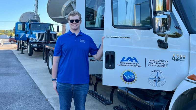
Conducted by UAH graduate student Zebulon W. Leffler, the work has been published in Geophysical Research Letters and is already being recognized as an important contribution to hurricane forecasting, emergency management, and our general understanding of storm behavior. Leffler completed this research as part of his master’s program while working as a graduate research assistant in UAH’s Earth System Science Center (ESSC) and the Department of Atmospheric and Earth Science (AES) under the supervision of Dr. Xiaomin Chen.
Leffler’s work focuses on what happens in the lowest part of a hurricane’s wind structure right after it hits land—an area where scientists historically struggled to make accurate predictions.
Why Wind Estimates Often Fail After Landfall
When a hurricane is still over water, forecasters can estimate surface winds using data from aircraft, satellites, and radar. The ocean’s smooth surface creates predictable wind behavior, allowing models to work reasonably well.
But once the storm crosses onto land, everything changes.
The rougher surface of the land quickly forms a shallow, newly developed layer of air near the ground. This layer, which Leffler highlights as a critical feature, becomes detached from the wind flow above it. Because past studies did not treat this shallow layer separately, they frequently underestimated near-surface wind speeds—a problem known as weak bias.
Accurate wind estimates in this transition zone are incredibly important. Surface winds influence everything from local emergency responses to post-disaster recovery, infrastructure planning, and risk communication. Even small inaccuracies can mean misjudging the severity of a storm’s impact.
What This Study Did Differently
To fix the estimation problems, Leffler refined the radar wind retrieval technique to better capture the fine vertical structure of the shallow layer that forms after landfall.
The study focused on two hurricanes:
- Hurricane Ida (2021)
- Hurricane Zeta (2020)
Researchers used data from the KLIX radar located near Slidell, Louisiana, and nearby wind measurement stations like the KASD ASOS station. By analyzing radar reflectivity and high-resolution wind velocities, Leffler was able to identify how the vertical wind profile changed near the surface during landfall.
He found that using radar-retrieved winds within the shallow layer dramatically improved estimates of actual surface wind speeds. The technique filled a major observational gap and corrected the systematic underestimations made by previous methods.
This work shows not only how near-surface winds evolve during landfall but also provides a much more accurate way to detect them in real time.
Key Details From the Research
To keep all specifics intact, here are the essential technical points presented in the published study and early summaries:
- The study analyzed hurricanes Ida (2021) and Zeta (2020) using six-hourly National Hurricane Center (NHC) best-track data.
- Radar reflectivity maps were created at 0.5° elevation to observe the storms at selected times during their landfall.
- A shallow atmospheric layer forms rapidly over land due to abrupt increases in surface friction, causing a separation between this layer and the winds above.
- Past research treated the entire vertical wind profile as a single structure, causing weak wind biases when attempting to estimate ground-level winds.
- Leffler’s refined method isolates the shallow layer and uses radar-derived winds within it to generate more accurate 10-meter wind estimates.
- The method demonstrated significant accuracy improvements over traditional approaches.
- UAH’s Mobile Alabama X-Band Radar (MAX) also supported parts of the broader research environment.
- Dr. Xiaomin Chen stresses that the research improves understanding of one of the most hazardous environments in atmospheric science.
- These findings will guide future surface wind forecast product development for hurricanes.
- Leffler plans to expand the work to additional storms, including Hurricane Laura (2020), which produced strong winds far inland.
- Future research will also examine radar platforms with lower antenna heights for even better near-surface detection.
Why This Matters Beyond Meteorology
Accurate near-surface wind estimates can save lives. Forecasters rely on them to:
- Design better warning systems
- Manage evacuations
- Plan power-grid protection
- Guide first responders during storm aftermath
- Predict damage severity for urban and rural regions
When wind estimations are wrong—especially when they underestimate actual wind speeds—communities may not prepare adequately. Leffler’s improved method reduces that risk.
Understanding the Boundary Layer in Hurricanes
Because this article should both inform and teach, here’s additional background on the atmospheric boundary layer (ABL) to help readers understand why this research is so important.
What Is the Boundary Layer?
The boundary layer is the lowest part of the atmosphere, directly influenced by the Earth’s surface. In hurricanes, this layer is extremely important because:
- It contains the strongest winds near the surface.
- Changes in friction determine how winds slow down or intensify.
- Surface features like water, cities, forests, and open land dramatically reshape the wind profile.
What Happens During Landfall?
Once a hurricane crosses from ocean to land:
- Surface roughness increases suddenly.
- Wind flow becomes disrupted.
- A new shallow internal boundary layer forms very quickly.
- This layer grows in depth and changes shape as the storm moves inland.
Because this layer evolves rapidly, static estimation methods fail. Leffler’s study is important because it directly measures and incorporates the structure of this shallow layer rather than assuming a simplified wind model.
How Radar Helps Measure Hurricane Winds
Most people know weather radar for showing rain or reflectivity maps, but modern Doppler radar also measures wind velocities.
During hurricanes, radars such as the WSR-88D (including the KLIX radar used in this study) can:
- Track wind speeds at different altitudes
- Detect patterns like boundary layer jets
- Capture rapid changes in wind structure as storms pass over land
However, radars struggle very close to the ground because:
- Buildings and terrain block signals
- The beam angle limits how low it can sample
- Weather radars are usually built several meters above the ground
This makes near-surface wind estimation tricky. Leffler’s refined method uses available radar levels more intelligently, especially within the shallow boundary layer that forms after landfall.
What This Innovation Means for Future Forecasting
The practical outcomes of this study are wide-reaching:
- Better hazard maps for wind damage
- More accurate inland wind forecasts, where storms often cause unexpected destruction
- Improved numerical models that simulate hurricanes
- Guidance for radar system upgrades, especially those with lower antenna heights
- Enhanced risk communication, ensuring communities receive accurate information during emergencies
It also demonstrates the value of supporting young researchers. A graduate student leading a project that improves real-world hurricane forecasting underscores the strong research environment at UAH’s ESSC and AES.
Research Paper Reference
Boundary Layer Observations and Near-Surface Wind Estimation During the Landfalls of Hurricanes Ida (2021) and Zeta (2020)
https://doi.org/10.1029/2025GL117487

